3 aerial modeling software outputs high resolution triangular model
2021-05-02
After obtaining the aerial survey data through the aerial survey software, it is necessary to process the data and extract valuable information, and image modeling is one of the conventional and practical processing methods. For the modeling function, Zhong Defu in the previous article "What software for UAV aerial survey? Here are 7 recommended software recommended in the 7 models. In addition to the functions of aerial survey data collection, there is also a special client/web to model the image.
However, unlike the 7 full-featured software that was previously recommended, Zhong Defu will recommend 3 software for modeling today.
ContextCapture
Formerly known as Smart3D, it is the main product of photogrammetry software developer Acute3D. Later, Acute3D was acquired by Bentley and renamed ContextCapture.
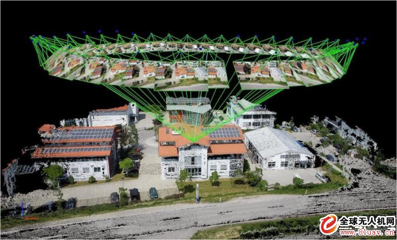
The modeling effect of ContextCapture (formerly Smart3D) has always been very good in the industry. It is said to be the result of 25 years of research by two of France's top research institutions, and its technical level is the industry benchmark. Internet giant Tencent has also worked with Acute3D to develop large-scale 3D city modeling for multiple megacities using aerial photography and streetscape photography. The implementation principle is different from the traditional image matching or object matching. Co ntextCapture is optimized globally based on the object mesh. The schematic diagram is as follows:
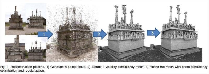
At the software usage level, Co ntextCapture has certain complexity and professionalism, including master-slave mode, Job Queue, control point editing, Tiling operation, water surface constraint, etc. All knowledge points need to be learned for a certain period of time to be flexible.
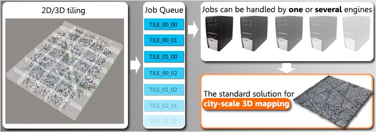
To ensure the output of the model, Co ntextCapture recommends that you take a different angle shot of the static model body and use the captured photo as the input data source. The best of these photos are accompanied by auxiliary data (the default drone default shooting settings will be retained), including sensor properties (focal length, sensor size, main point, lens distortion), photo position parameters (GPS), photo pose parameters (INS) ), control points, and more. In this way, a truly high-resolution triangular mesh model with real texture can be output. This triangular mesh model can accurately and accurately restore the true color, geometry and detail of the modeling subject.

Photoscan
Photoscan is a set of software for automatically generating 3D models based on images developed by Russian software company AgiSoft.
The genuine price of Photoscan Professional is as high as $3,499, but due to national conditions, there have been cracked versions on the Internet. In addition to being used for 3D modeling, many users have used it in the splicing of panoramic photos. The good fusion algorithm of the software can properly compensate for the lack of matching accuracy of overlapping images.

In use, Photoscan provides a nearly foolish operation process: install the software and import photos, the software will align the photos, find the shooting angle and distance, and when completed, will establish a dense cloud, calculate the relationship between each point Each of the identified points is included in the intensive calculation; after that, the grid is generated, and the vector function relationship between the points is established, and then connected according to the actual situation, and a 3D model which becomes a point line surface is constructed, which is established at this time. A set of 3D shapes of the planar image; finally, the texture is generated. The software distributes the planar image to the 3D model according to the data when the dense cloud is built. At this time, the model has an internal structure and an external image, and a preliminary 3D model has been formed.

If you compare the modeling software to the Meitu app, the ContentCapture corresponds to Photoshop, and the Photoscan is more like the Mito show. From the software functions and interface, Photoscan is really light, so in terms of modeling effects, Photoscan's word of mouth is also uneven.
OpenDroneMap
OpenDro neMap is an open source aerial image processing tool that converts aerial images into point clouds, orthophotos, and elevation models.
The biggest feature of OpenDro neMap is open source and free. Open source means that developers can deploy OpenDro neMap to their own computers or servers to provide modeling services.
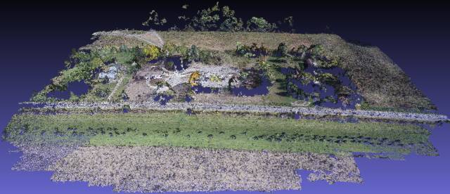
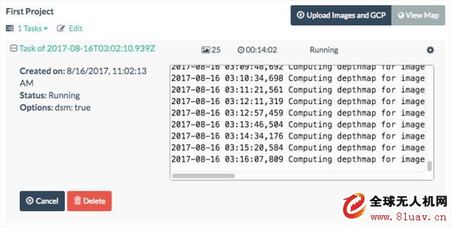
If you just deploy the OpenDro neMap open source library, you will get the command line interface, which requires you to enter specific command line instructions for each operation. However, OpenDro neMap also provides WebODM, which is called Web OpenDroneMap. As its name suggests, it is the Web interface version of OpenDro neMap. Compared to OpenDro neMap's command line interface, the same image processing function, WebODM is equipped with a user-friendly UI interface. The user experience is better. In addition, WebODM can generate a variety of results, including point cloud, GeoTIFF, etc., can test or display the length, area, etc. in the web interface, which is more conducive to GIS analysis and research.
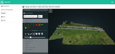
When you deploy and install WebODM, the next steps are much simpler: create a project — upload a picture — wait for processing — download the output.

JRT produced the high resolution optical distance measurement sensor for 16 years with lower cost. Our distance measuring sensor have small size, high accuracy.
The laser range finder components is characterized by an above-average measured value output frequency, up to 8hz. The miniature laser distance module is also suitable for monitoring defined distance and height during transport.
Distance Measuring Sensor, Accurate Laser Measuring Sensor, High Accuracy Distance Sensor, Optical Distance Sensors
YCX Electronics Co., Ltd. http://www.accuracysensor.com
